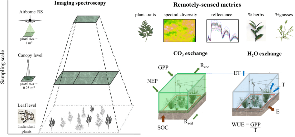
Scaling-up ecosystem fluxes with imaging spectroscopy
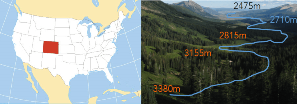
Vegetation properties at local and global scales are important predictors of the exchange of water and carbon in terrestrial ecosystems. However, quantifying vegetation change across space and time continues to be challenging with field-based methods. Remote sensing overcome this challenge by mapping the continuous of vegetation change across large enviromental gradients, but it remains unclear what is the appropriate scale to quantify vegetation properties using remote sensing, and how the sampling scale affects our ability to predict terrestrial ecosystem function. This project focuses on i) evaluating whether diversity metrics derived from imaging spectroscopy predict carbon and water fluxes, ii) how this predictability changes across sampling scales, and iii) examine the relative importance of abiotic conditions vs. remotely-sensed diversity metrics to predict ecosystem fluxes.
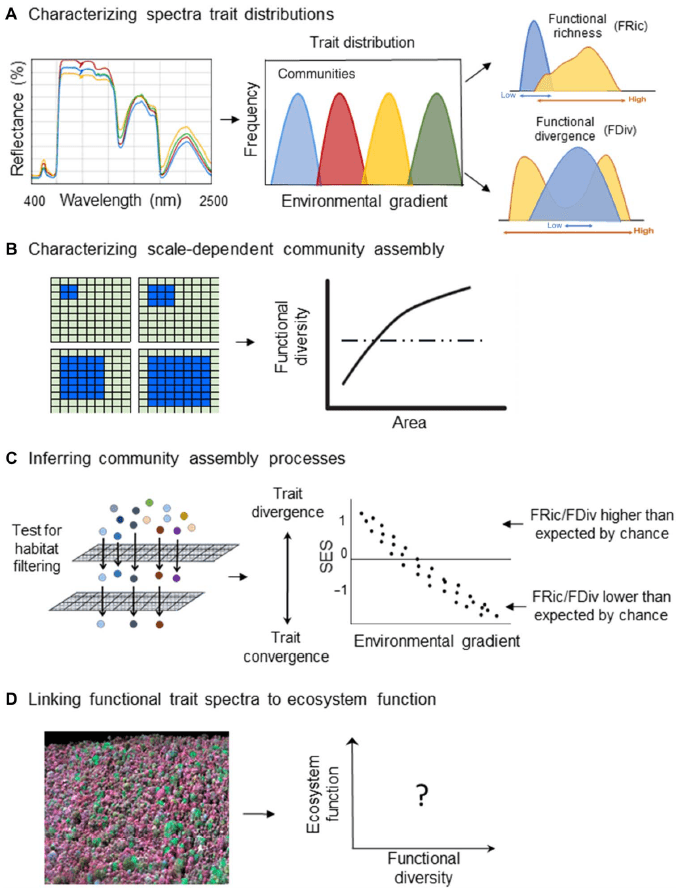
Remote sensing of functional diversity
Airborne remote sensing has been used to assess forest extent, and map the chemical diversity across different scales, but estimations of other diversity components such as functional diversity remains a challenge, specifically in hyper diverse systems such as tropical forests. We evaluated the potential of airborne imaging to quantify functional diversity of tree communities, and whether remotely-sensed indices can be used to answer ecological questions related to community assembly and linkages of traits and productivity. We used remotely-sensed traits across a broad Amazon–to–Andes elevation gradient (215–3537 m) in nine 1-hectare sites in southern Peru (Durán et al. 2019).